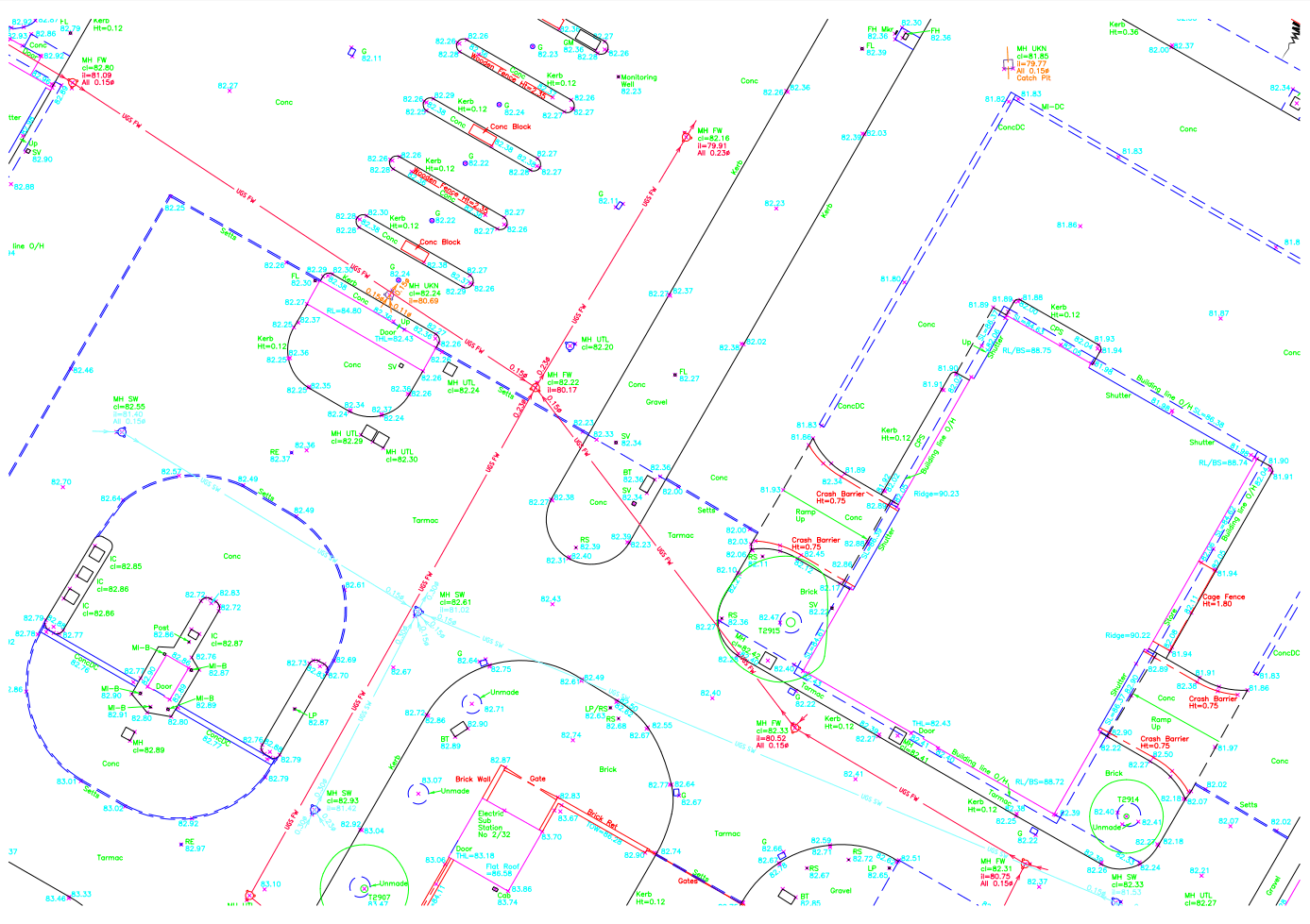
Topographical Surveys
A Topographical Survey (sometimes referred to as a Land Survey) is the process to produce an accurate and detailed map of the features both man-made and natural within an area. The collected data may be presented in many formats from a simple paper plan to a full 3D digital model depending on the client’s requirements. Today the most common presentation is as a digital data set which is also plotted out as drawings on paper. For more information on topographical surveys please read the ‘TSA CLIENT GUIDE TO TOPOGRAPHICAL SURVEYS’
All our field data is captured using the latest Leica Total Stations and GPS and then processed in our offices using our networked computer facilities to produce either a 2D or 3D model. We can output data to clients in a variety of formats including AutoCAD, Microstation, MOSS and many more.