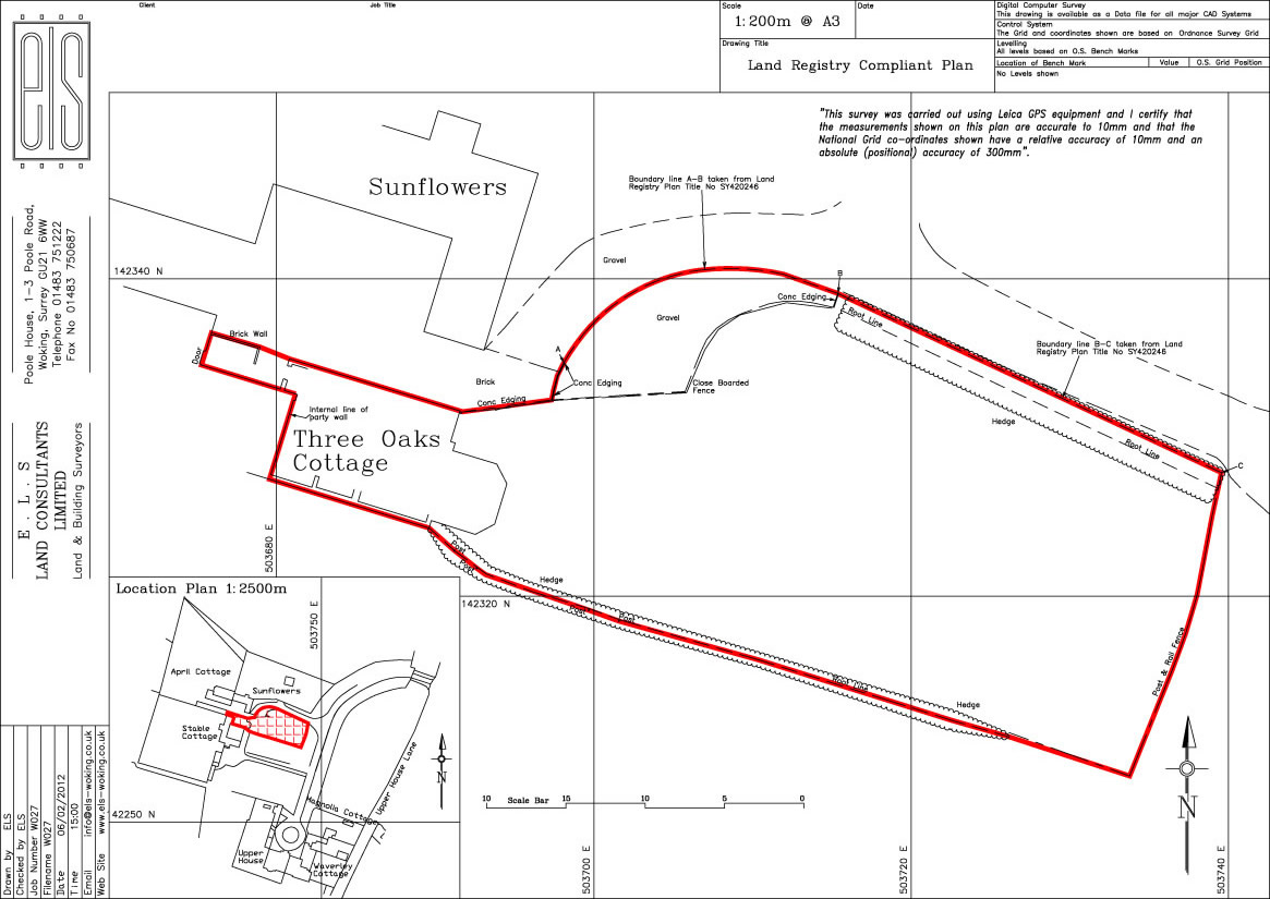
Land Registry Compliant Plans & Determined Boundary Plans
Most parcels of land in England has a plan and a registered title showing its boundaries and is held and maintained by Land Registry. Most plans are based on the Ordnance Survey map and the majority of them show the general boundaries, not the exact boundary or its type. The Ordnance Survey plans are also subject to specified accuracy tolerances, therefore, measurements scaled between features shown on the plan will not necessarily match measurements taken between the features on site.
ELS are often requested to check the position of the boundaries of a parcel of land that has or is being bought by a Client to make sure that they are correct. Field measurements are captured using survey instruments and collated with any existing Land Registry plans and the Ordnance Survey digital data. An autocad survey plan or Land Registry Compliant Plan of the boundaries is produced and can be registered with the Land Registry.
Any boundaries not visible on site can be set out and any areas can be calculated.
A determined boundary plan can be produced for showing the boundaries more exactly by showing dimensions and coordinates along the boundary.